Geoinformation System for Campus Management
Description
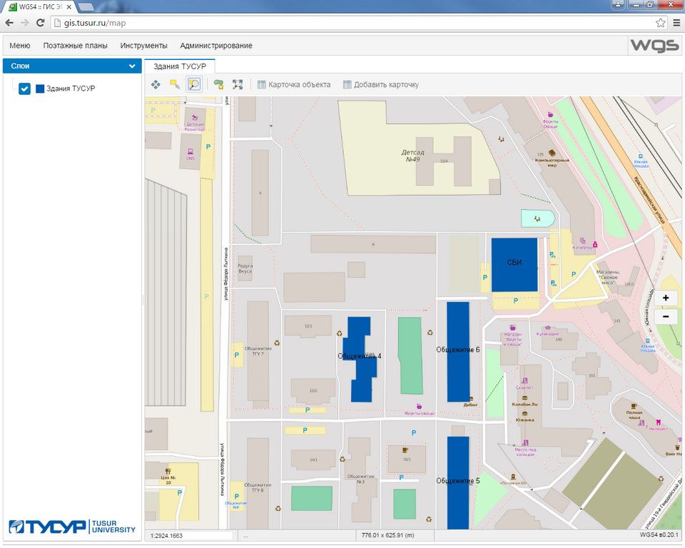
The Campus Management GIS is a three-tier-architecture web app that consists of the client and the server end, and a data storage. The system displays all university property (buildings, structures and utilities) on a digital map of the city.
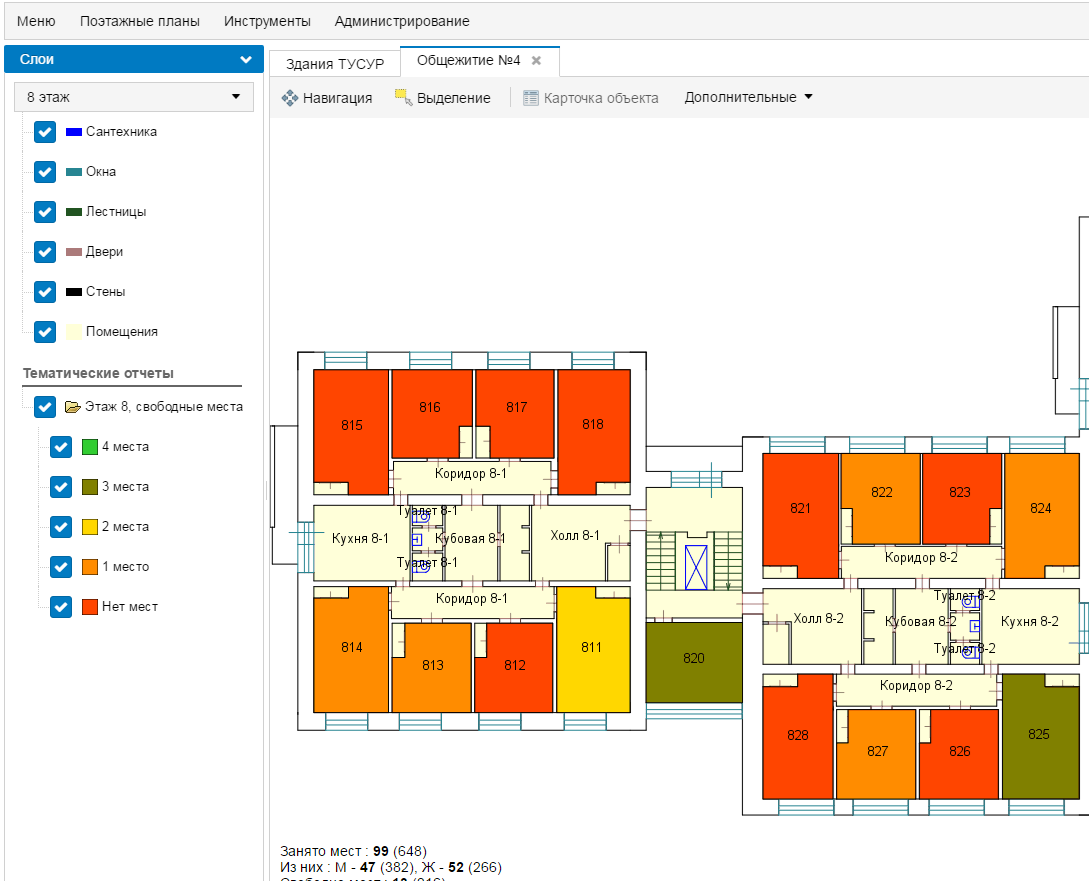
The user can obtain both visual and attributive (descriptive) information on each property. Depending on their role in the system, the user may be able to view or edit the information and to generate various reports.
- display of buildings, sporting facilities and other structures on an interactive digital map,
- display of floor plans for university buildings with descriptive information on each room (data on dormitory rooms and student residents, classrooms, etc.),
- integration with the university’s corporate database for various user inquiries (use of classrooms, timetables, student accommodation, etc.),
- customization (to add or remove fields, etc.) of information cards without adjustments to the system.
Specifications
System requirements of the Campus Management GIS:
Client end: modern Webkit (Chromium based) or Gecko (Mozilla Firefox) based web browser
Server end: 4 core 2.5 GHz processor, 4 Gb RAM, 20 Gb free disk space, Windows Server 2008/2012 x64 OS
Data storage: SQL-based engine PostgreSQL
Advantages
- System access from any computer via web browser and internet/intranet connection
- Comprehensive customization in accordance with the needs and data of any university without programmers’ involvement
- Can be used with freeware
Application
Universities and other institutions that require a special tool to control and manage their facilities.